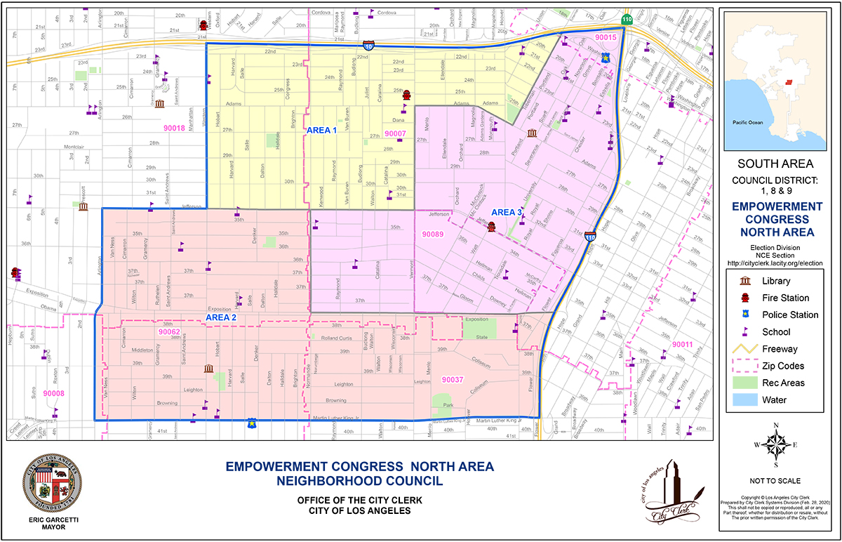
Area Boundaries and Map
"Download High Quality PDF"
What are the Council’s Boundaries?
North: 10 Freeway
South: Martin Luther King Boulevard
East: 110 Freeway
West: Arlington Avenue between Martin Luther King Boulevard and Jefferson Boulevard and Western Avenue, between Martin Luther King Boulevard and the 10 Freeway
The Council’s boundaries are further broken into three areas, with two elected representatives for each.
Area 1:
Starting at the corner of Jefferson Boulevard and Western Avenue, head north on Western Avenue to the 10 Freeway. East on the 10 Freeway to Toberman Street. Southwest on Toberman Street to West Adams Boulevard. West on West Adams Boulevard to Vermont Avenue. South on Vermont Avenue to Jefferson Boulevard. West on Jefferson Boulevard to starting point.
Area 2:
Starting at the corner of Martin Luther King Boulevard and Arlington Avenue, head north on Arlington Avenue to Jefferson Boulevard. East on Jefferson Boulevard to Normandie Avenue. South on Normandie Avenue to Exposition Boulevard. East on Exposition Boulevard to the 110 Freeway. South on the 110 Freeway to Martin Luther King Boulevard. West on Martin Luther King Boulevard to starting point.
Area 3:
Starting at the corner of Exposition Boulevard and Normandie Avenue, head north on Normandie Avenue to Jefferson Boulevard. East on Jefferson Boulevard to Vermont Avenue. North on Vermont Avenue to West Adams Boulevard. East on West Adams Street to Toberman Street. Northeast on Toberman Street to the 10 Freeway. East on the 10 Freeway to the 110 Freeway going south. 110 Freeway south exit going west on Exposition Boulevard. Exposition Boulevard to starting point.